Nota: para la visualización se recomienda utilizar Google Chrome (versión 56 o superior) o Mozilla Firefox (versión 45 o superior)
Nota divulgativa
Datos
- Servicios web de visualización (WMS) y descarga (WFS):
- WMS: http://www.juntadeandalucia.es/institutodeestadisticaycartografia/geoserver-ieca/rta/wms?
- WFS: http://www.juntadeandalucia.es/institutodeestadisticaycartografia/geoserver-ieca/rta/wfs?
Actualizaciones
- Última actualización: 17/12/2020
Actividades relacionadas
Ámbito territorial
Municipal
Saber más
Experiencia piloto para una Red de Transporte de Andalucía (RTA) a partir de los modelos de los sistemas de información del Callejero Digital de Andalucía Unificado (CDAU) y la Base Cartográfica de Andalucía (BCA), en la que se recojan las diferentes modalidades de transporte y se cubran las necesidades que se planteen en este ámbito de actuación por parte de los distintos usuarios (Administraciones, empresas y ciudadanía en general), sobre todo en lo que se refiere al cálculo de rutas y la navegación.
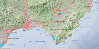
El ámbito geográfico de esta experiencia piloto incluye 15 municipios del extremo más oriental de la provincia de Almería y se presenta como una oportunidad de desarrollar una metodología para la generación y el mantenimiento de una Red de Transporte de Andalucía (RTA) a partir de las fuentes de información disponibles.


