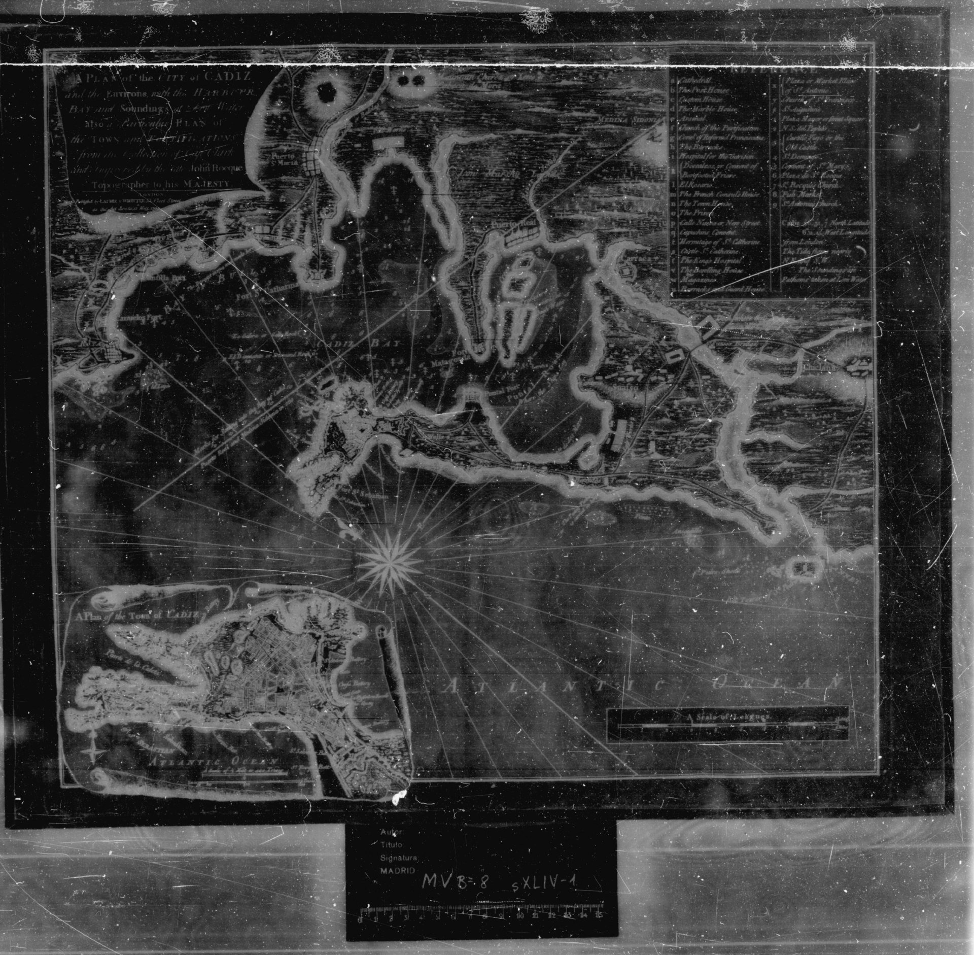
Mapa
Exportar ficha


RESERVADOS TODOS LOS DERECHOS Prohibida la reproducción, total o parcial de los contenidos de la web de la Cartografía Histórica de Andalucía, por cualquier medio bien sea mecánico o electrónico, sin la autorización previa y por escrito del Instituto de Estadística y Cartografía de Andalucía. Los mapas, planos o vistas históricas suministrados por este medio son propiedad exclusiva de sus respectivos organismos depositarios, por lo que la copia facilitada por el Instituto de Estadística y Cartografía de Andalucía solo podrá ser utilizada con fines exclusivos de investigación. En los casos de uso para publicación, edición o exhibición públicas, la obligatoria autorización corresponde solicitarla ante el titular legal de los derechos, de conformidad con la Real Decreto Legislativo 1/1996, de 12 de abril, por el que se aprueba el Texto Refundido de la Ley de Propiedad Intelectual.
POLÍTICA DE PROTECCIÓN DE DATOS En cumplimiento de lo dispuesto en la Ley Orgánica 3/2018, de 5 de diciembre, de Protección de Datos Personales y garantía de los derechos digitales, que adapta el ordenamiento jurídico español al Reglamento (UE) 2016/679 de 27 de abril de 2016 relativo a la protección de las personas físicas en lo que respecta al tratamiento de datos personales, le informamos:
- La responsable del tratamiento de sus datos personales es la Subdirección del Área de Coordinación, Comunicación y Métodos: resprat.ieca@juntadeandalucia.es. El contacto del Delegado de Protección de Datos es: dpd.ieca@juntadeandalucia.es
- La finalidad del tratamiento es gestionar su solicitud o petición.
- La base jurídica del tratamiento está recogida en el artº 6.1.e del Reglamento (UE) 2016/679.
- Puede ejercer sus derechos de acceso, rectificación y supresión, portabilidad de sus datos, y la limitación u oposición a su tratamiento ante el responsable del tratamiento.
-
Puede encontrar
información detallada en:
http://www.juntadeandalucia.es/institutodeestadisticaycartografia/protecciondedatos/index.html
CONDICIONES GENERALES Mediante este aviso legal y de conformidad con lo establecido en la Ley 34/2002 de 11 de julio de Servicios de la Sociedad de la Información y Comercio Electrónico, el Instituto de Estadística y Cartografía de Andalucía informa al usuario que el envío de la solicitud de productos cartográficos implica la aceptación de las condiciones del servicio. A este efecto, el Instituto de Estadística y Cartografía de Andalucía pone a disposición de los usuarios la dirección de correo electrónico cartoteca.ieca@juntadeandalucia.es y el teléfono 900 101 407 a fin de facilitar la identificación y la corrección de errores en la introducción de datos. Con renuncia expresa de su propio fuero, las partes se someten a la jurisdicción de los juzgados y tribunales de Sevilla. La utilización indebida de esta aplicación dará lugar a las correspondientes responsabilidades.
| Código | Indicador | Subcampos |
|---|---|---|
| 001 | IECA1988015056 | |
| 005 | 19911015230000 | |
| 007 | ajocanbn | |
| 008 | 911016m17621794GBRb a 0 eng j | |
| 034 | 1# | $aa$b119100 |
| 035 | ## | $6https://www.culturaydeporte.gob.es/portada.html$aMinisterio de Educación, Cultura y Deporte. Biblioteca Nacional-MV;Bª8/Serie XLIV-1 |
| 041 | 0# | $aeng |
| 045 | 0# | $b1762 |
| 080 | ## | $a(468.181.3 Cádiz) | 080 | ## | $a(468.181.3-2) |
| 130 | ## | $aCádiz (Bahía)$f1794$kCartas náuticas |
| 245 | ## | $aA Plan of the City of Cadiz and the environs with the Harbour, Bay and Soundings at Low Water also a Particular Plan of the Town and the Fortifications from the Collection of Capt. Clark and Improved by the late John Rocque, Topographer to his Majesty |
| 255 | ## | $aEscala [ca. 1:119100] Escala gráfica 3 leagues [= 14 cm] |
| 260 | ## | $aLondon$bPublished by Laurie & Whittle, 53 Fleet Street as the Act directs, 12Th.$cMay, 1794 |
| 300 | ## | $a1 carta náutica$bgrab., col., papel$c49 x 52 cm |
| 500 | ## | $aOrientado con rosa y lis con el N. al NO. de la carta náutica | 500 | ## | $aIndica rumbos y sondas | 500 | ## | $aArbolado representado | 500 | ## | $aInserta en el ángulo inferior izquierdo, sobre un pergamino : A plan of the Town of Cadiz. - [ca. 1:16166], 600 Toises [= 7,2 cm]. - Orientado con rosa con lis. - 14 x 22 cm | 500 | ## | $aRelieve por sombreado | 500 | ## | $aPertenece a la Colección Mendoza | 500 | ## | $aEl ejemplar del ICC tiene fecha de 1762, en margen inferior derecho figura: "Published according to Act of Parliment by Mary Ann Roque, near Old Round court in the strand |
| 501 | ## | $aCon plano de detalle del Casco de Cádiz: "A Plan of the Town Cadis" Escala gráfica [ca. 1:16.200] 1/2 Mile or 440 toises [5,41 cm] y 600 toises [7,21 cm]. |
| 534 | ## | $e1 carta náutica, grab., col., 49 x 52 cm | 534 | ## | $pVersión original |
| 650 | 17 | $aCartas náuticas | 650 | 27 | $aFortificaciones |
| 651 | #7 | $aCádiz (Bahía$zCádiz) | 651 | #7 | $aCádiz (Casco urbano) |
| 700 | 0# | $aClark, I. | 700 | 0# | $aRocque, John$cTopographer to his Majesty |
| 710 | 1# | $aLaurie and Whittle$c(Londres) |
| 856 | 4# | $uhttp://bibliotecadigitalhispanica.bne.es:80/webclient/DeliveryManager?pid=91157 | 856 | 4# | $uhttp://cartotecadigital.icc.cat/cdm/singleitem/collection/espanya/id/1934/rec/41 |
| 906 | 0# | $b1794 |