Mapa
Exportar ficha


RESERVADOS TODOS LOS DERECHOS Prohibida la reproducción, total o parcial de los contenidos de la web de la Cartografía Histórica de Andalucía, por cualquier medio bien sea mecánico o electrónico, sin la autorización previa y por escrito del Instituto de Estadística y Cartografía de Andalucía. Los mapas, planos o vistas históricas suministrados por este medio son propiedad exclusiva de sus respectivos organismos depositarios, por lo que la copia facilitada por el Instituto de Estadística y Cartografía de Andalucía solo podrá ser utilizada con fines exclusivos de investigación. En los casos de uso para publicación, edición o exhibición públicas, la obligatoria autorización corresponde solicitarla ante el titular legal de los derechos, de conformidad con la Real Decreto Legislativo 1/1996, de 12 de abril, por el que se aprueba el Texto Refundido de la Ley de Propiedad Intelectual.
POLÍTICA DE PROTECCIÓN DE DATOS En cumplimiento de lo dispuesto en la Ley Orgánica 3/2018, de 5 de diciembre, de Protección de Datos Personales y garantía de los derechos digitales, que adapta el ordenamiento jurídico español al Reglamento (UE) 2016/679 de 27 de abril de 2016 relativo a la protección de las personas físicas en lo que respecta al tratamiento de datos personales, le informamos:
- La responsable del tratamiento de sus datos personales es la Subdirección del Área de Coordinación, Comunicación y Métodos: resprat.ieca@juntadeandalucia.es. El contacto del Delegado de Protección de Datos es: dpd.ieca@juntadeandalucia.es
- La finalidad del tratamiento es gestionar su solicitud o petición.
- La base jurídica del tratamiento está recogida en el artº 6.1.e del Reglamento (UE) 2016/679.
- Puede ejercer sus derechos de acceso, rectificación y supresión, portabilidad de sus datos, y la limitación u oposición a su tratamiento ante el responsable del tratamiento.
-
Puede encontrar
información detallada en:
http://www.juntadeandalucia.es/institutodeestadisticaycartografia/protecciondedatos/index.html
CONDICIONES GENERALES Mediante este aviso legal y de conformidad con lo establecido en la Ley 34/2002 de 11 de julio de Servicios de la Sociedad de la Información y Comercio Electrónico, el Instituto de Estadística y Cartografía de Andalucía informa al usuario que el envío de la solicitud de productos cartográficos implica la aceptación de las condiciones del servicio. A este efecto, el Instituto de Estadística y Cartografía de Andalucía pone a disposición de los usuarios la dirección de correo electrónico cartoteca.ieca@juntadeandalucia.es y el teléfono 900 101 407 a fin de facilitar la identificación y la corrección de errores en la introducción de datos. Con renuncia expresa de su propio fuero, las partes se someten a la jurisdicción de los juzgados y tribunales de Sevilla. La utilización indebida de esta aplicación dará lugar a las correspondientes responsabilidades.
| Código | Indicador | Subcampos |
|---|---|---|
| 001 | IECA1988014409 | |
| 005 | 19911117230000 | |
| 007 | aj-canzn | |
| 008 | 911118 18111899espXXaXXXXXzXespdm 6f6af | |
| 034 | 1# | $aa$b100000 |
| 035 | ## | $6https://lustau.es/$aCasa de D. Emilio Lustau (Jerez de la Frontera, Cádiz) |
| 041 | 0# | $aspa |
| 045 | 0# | $b1811 |
| 130 | ## | $aCádiz (Bahía)$f1811$kBatallas |
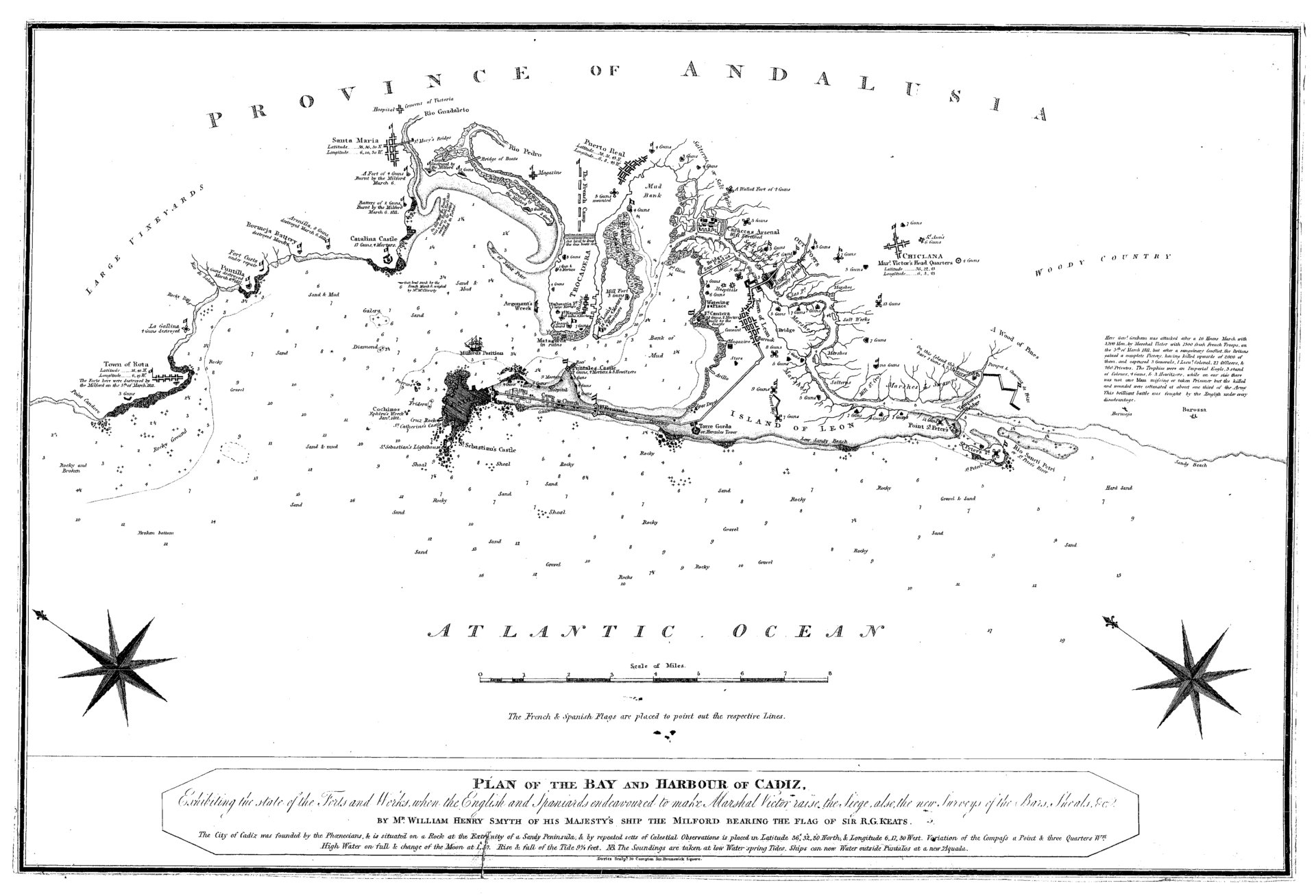
| 245 | ## | $aPlan of the Bay and Harbour of Cadiz$bExibihing the state of forts and works, When the English and Spanierds endeavoured to make Marshal Victor raise the sige, also, the new surveys of the bars, shoals$cBy Mr William Henry Smyth of his majesty's ship the milford Bearing the flag of Sr. R. G. Keats |
| 255 | ## | $aEscala [ca. 1:10.0000] Escala gráfica en millas |
| 260 | ## | $bDanies Sult 10 Compton$c1811 |
| 300 | ## | $a1 mapa$bgrabado papel b y n$c47 x 32 cm |
| 500 | ## | $aGrabado sobre papel | 500 | ## | $aEl único color que tiene está en las banderas de los ejércitos | 500 | ## | $aRotulados los nombres de las ciudades con la latitud y la longitud | 500 | ## | $aAparecen rotuladas la naturaleza de los fondos y sus profundidades | 500 | ## | $aLos núcleos de población tienen un pequeño plano (excepto Cádiz) | 500 | ## | $aEn buenas condiciones | 500 | ## | $aNota descriptiva sobre la ciudad de Cádiz su historia y situación |
| 534 | ## | $e1 mapa grabado papel b y n 47 x 32 cm | 534 | ## | $pVersión original |
| 650 | 17 | $aBatallas |
| 651 | #7 | $aCádiz (Bahía$zCádiz) |
| 700 | 0# | $aSmyth, William Henry |
| 710 | 1# | |
| 906 | 0# | $b1811 |