Mapa
Exportar ficha


RESERVADOS TODOS LOS DERECHOS Prohibida la reproducción, total o parcial de los contenidos de la web de la Cartografía Histórica de Andalucía, por cualquier medio bien sea mecánico o electrónico, sin la autorización previa y por escrito del Instituto de Estadística y Cartografía de Andalucía. Los mapas, planos o vistas históricas suministrados por este medio son propiedad exclusiva de sus respectivos organismos depositarios, por lo que la copia facilitada por el Instituto de Estadística y Cartografía de Andalucía solo podrá ser utilizada con fines exclusivos de investigación. En los casos de uso para publicación, edición o exhibición públicas, la obligatoria autorización corresponde solicitarla ante el titular legal de los derechos, de conformidad con la Real Decreto Legislativo 1/1996, de 12 de abril, por el que se aprueba el Texto Refundido de la Ley de Propiedad Intelectual.
POLÍTICA DE PROTECCIÓN DE DATOS En cumplimiento de lo dispuesto en la Ley Orgánica 3/2018, de 5 de diciembre, de Protección de Datos Personales y garantía de los derechos digitales, que adapta el ordenamiento jurídico español al Reglamento (UE) 2016/679 de 27 de abril de 2016 relativo a la protección de las personas físicas en lo que respecta al tratamiento de datos personales, le informamos:
- La responsable del tratamiento de sus datos personales es la Subdirección del Área de Coordinación, Comunicación y Métodos: resprat.ieca@juntadeandalucia.es. El contacto del Delegado de Protección de Datos es: dpd.ieca@juntadeandalucia.es
- La finalidad del tratamiento es gestionar su solicitud o petición.
- La base jurídica del tratamiento está recogida en el artº 6.1.e del Reglamento (UE) 2016/679.
- Puede ejercer sus derechos de acceso, rectificación y supresión, portabilidad de sus datos, y la limitación u oposición a su tratamiento ante el responsable del tratamiento.
-
Puede encontrar
información detallada en:
http://www.juntadeandalucia.es/institutodeestadisticaycartografia/protecciondedatos/index.html
CONDICIONES GENERALES Mediante este aviso legal y de conformidad con lo establecido en la Ley 34/2002 de 11 de julio de Servicios de la Sociedad de la Información y Comercio Electrónico, el Instituto de Estadística y Cartografía de Andalucía informa al usuario que el envío de la solicitud de productos cartográficos implica la aceptación de las condiciones del servicio. A este efecto, el Instituto de Estadística y Cartografía de Andalucía pone a disposición de los usuarios la dirección de correo electrónico cartoteca.ieca@juntadeandalucia.es y el teléfono 900 101 407 a fin de facilitar la identificación y la corrección de errores en la introducción de datos. Con renuncia expresa de su propio fuero, las partes se someten a la jurisdicción de los juzgados y tribunales de Sevilla. La utilización indebida de esta aplicación dará lugar a las correspondientes responsabilidades.
| Código | Indicador | Subcampos |
|---|---|---|
| 001 | IECA1988000150 | |
| 005 | 19910521230000 | |
| 007 | harbpv baaa | |
| 008 | 910522s1725 GBR aj engdm 6s6ae | |
| 034 | 1# | $aa$b4575 |
| 035 | ## | $6https://armada.defensa.gob.es/museonaval/$aMuseo Naval E- LIV-8 |
| 041 | 0# | $aeng |
| 045 | 0# | $b1725 |
| 130 | ## | $aGibraltar$f1725$kFortificaciones costeras |
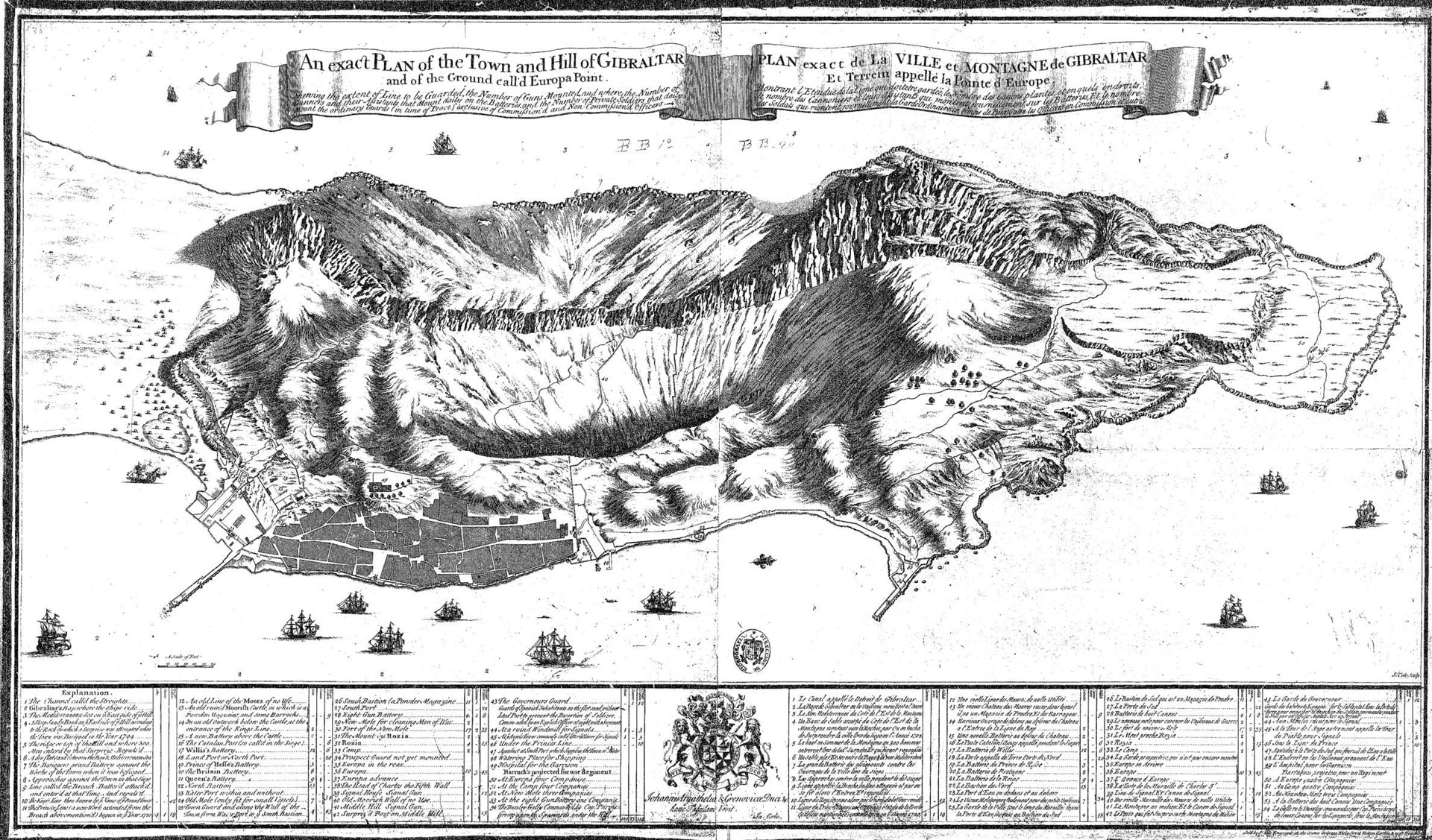
| 245 | ## | $aAn Exact Plan of the Town and Hill of Gibraltar and of the fround coll'd Europa Point = Plan exact de la ville et montagne de Gibraltar et terrein appellé la Pointe d'Europa$bsheving the extend of line to be guarded, the number of guns mounted and where, the number of gunners and their assistans that mount daily on the Batteries and the number of private soldiers that daily mount the ordinary guards (in time of peace) exclusive of commission'd and non commission'd officers$cJa. Cole$h[Material cartográfico] |
| 255 | ## | $aEscala [ca. 1:4575] Escala gráfica de 600 pies ingleses, hory fuards (in time of peace) [= 4 cm] |
| 260 | ## | $aLondon$bCole engraver at the crown in great kirly street$c1725 |
| 300 | ## | $a1 plano$bgrab. sobre papel$c100 x 59 cm |
| 500 | ## | $aOrientado con lis, el N al SO del plano | 500 | ## | $aEn el margen inferior explicación toponímica y de las fuerzas atacantes, en medio un escudo con la firma del autor y la leyenda | 500 | ## | $aDedicatoria : Johannis Argathelia frenovicae Duci hanc tabulam vovitas | 500 | ## | $aRelieve representado por sombra y perfil |
| 534 | ## | $pVersión original | 534 | ## | $e1 plano grab. sobre papel 100 x 59 cm |
| 650 | 27 | $aPlanos de población | 650 | 17 | $aFortificaciones costeras |
| 651 | #7 | $aGibraltar$zGibraltar) |
| 700 | 0# | $aJa. Cole |
| 710 | 1# | |
| 906 | 0# | $b1725 |