Nota: para la visualización se recomienda utilizar Google Chrome (versión 56 o superior) o Mozilla Firefox (versión 45 o superior)
Nota divulgativa
Datos
- Descarga de información como:
Ámbito territorial
Malla estadística
Metodología
- Memoria técnica (pdf)
- Informe metodológico estandarizado (pdf)
- Indicadores de calidad (pdf)
- Informe técnico sobre la geocodificación y la georreferenciación (pdf)
- Tutorial: Distribución de la Población de Andalucía en celdas de 250 metros de lado
- Tutorial: Cómo visualizar los datos de la Distribución Espacial de la Población en Andalucía
- Tutorial: Cómo trabajar con la información del visor de Distribución Espacial de la Población
- Tutorial: Cómo descargar una selección territorial de datos del Grid de población del IECA
- Tutorial: Cómo obtener información sobre barrios a partir de la Distribución Espacial de la Población de Andalucía
Actividades relacionadas

Saber más
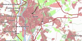
La información que se representa en estos mapas proviene del Base de Datos Longitudinal de Población de Andalucía (BDLPA) a fecha de 1 de enero del año de referencia y ha sido georreferenciada partiendo de la localización de la dirección postal donde reside cada uno de los habitantes de Andalucía.
Para facilitar la representación de la información y para preservar el secreto estadístico se ha trazado una malla regular con celdas de 250 metros de lado, donde ha quedado agregada toda la información que corresponde en cada caso. La información que no se ha podido georreferenciar ha sido estimada utilizando técnicas de análisis espacial.
Se ofrece información sobre población (población total, por sexo, nacionalidad o grupos de edad), afiliación a la Seguridad Social (afiliación total, por sexo o relación laboral), pensiones contributivas de la Seguridad Social (perceptores de pensiones contributivas, por sexo, por tipo, así como ingresos por pensiones de jubilación, viudedad, jubilación y viudedad, incapacidad u otro tipo de pensiones) y demandantes de empleo del Servicio Andaluz de Empleo (demandantes de empleo total, por sexo o paro registrado).