Nota: para la visualización se recomienda utilizar Google Chrome (versión 56 o superior) o Mozilla Firefox (versión 45 o superior)
Nota divulgativa
Datos
Servicios de visualización (WMS)
| Relieve | http://www.ideandalucia.es/services/DERA_g1_relieve/wms? |
| Infraestructura geográfica | http://www.ideandalucia.es/services/DERA_g2_infra_geografica/wms? |
| Hidrografía | http://www.ideandalucia.es/services/DERA_g3_hidrografia/wms? |
| Medio físico | http://www.ideandalucia.es/services/DERA_g4_medio_fisico/wms? |
| Medio marino | http://www.ideandalucia.es/services/DERA_g5_medio_marino/wms? |
| Usos del suelo | http://www.ideandalucia.es/services/DERA_g6_usos_suelo/wms? |
| Sistema urbano | http://www.ideandalucia.es/services/DERA_g7_sistema_urbano/wms? |
| Tejido económico-productivo | http://www.ideandalucia.es/services/DERA_g8_tejido_economico/wms? |
| Transportes y comunicaciones | http://www.ideandalucia.es/services/DERA_g9_transport_com/wms? |
| Infraestructuras energéticas y medioambientales | http://www.ideandalucia.es/services/DERA_g10_infra_energetica/wms? |
| Patrimonio | http://www.ideandalucia.es/services/DERA_g11_patrimonio/wms? |
| Servicios | http://www.ideandalucia.es/services/DERA_g12_servicios/wms? |
| Límites administrativos | http://www.ideandalucia.es/services/DERA_g13_limites_administrativos/wms? |
Servicios de descarga (WFS)
| Relieve | http://www.ideandalucia.es/services/DERA_g1_relieve/wfs? |
| Infraestructura geográfica | http://www.ideandalucia.es/services/DERA_g2_infra_geografica/wfs? |
| Hidrografía | http://www.ideandalucia.es/services/DERA_g3_hidrografia/wfs? |
| Medio físico | http://www.ideandalucia.es/services/DERA_g4_medio_fisico/wfs? |
| Medio marino | http://www.ideandalucia.es/services/DERA_g5_medio_marino/wfs? |
| Usos del suelo | http://www.ideandalucia.es/services/DERA_g6_usos_suelo/wfs? |
| Sistema urbano | http://www.ideandalucia.es/services/DERA_g7_sistema_urbano/wfs? |
| Tejido económico-productivo | http://www.ideandalucia.es/services/DERA_g8_tejido_economico/wfs? |
| Transportes y comunicaciones | http://www.ideandalucia.es/services/DERA_g9_transport_com/wfs? |
| Infraestructuras energéticas y medioambientales | http://www.ideandalucia.es/services/DERA_g10_infra_energetica/wfs? |
| Patrimonio | http://www.ideandalucia.es/services/DERA_g11_patrimonio/wfs? |
| Servicios | http://www.ideandalucia.es/services/DERA_g12_servicios/wfs? |
| Límites administrativos | http://www.ideandalucia.es/services/DERA_g13_limites_administrativos/wfs? |
Metodología
Actividades relacionadas
Ámbito territorial
Lineal, Puntual, Superficial
Saber más
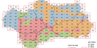
Datos Espaciales de Referencia de Andalucía (DERA) es un repertorio de bases cartográficas de diferente naturaleza geométrica (puntos, líneas, polígonos, imágenes ráster) referidas al territorio andaluz.
Se presenta en bloques temáticos (relieve, hidrografía, transportes y comunicaciones, divisiones administrativas, etc) que permiten el acceso centralizado a información de muy distinta procedencia con garantía de actualización, coherencia geométrica y continuidad territorial.
Así mismo, se acompaña de dos bloques de datos espaciales que permiten contextualizar a Andalucía en el mundo y en su entorno más inmediato, además de un bloque de toponimia para usar en la maquetación de mapas.
Todo ello facilita a investigadores, profesionales, docentes y técnicos elaborar sus propias salidas cartográficas, su uso en funciones analíticas complejas y la generación de productos y aplicaciones.